


September 2, 2019 – In Breaking News – The Washington Post
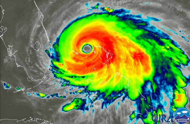
Category 5 Hurricane Dorian parked itself over the northwestern Bahamas on Sunday night and Monday morning, unleashing a devastating storm surge, destructive winds and blinding rain.
Perched perilously close to the Florida peninsula, Monday is the critical day that is likely to determine whether the state is dealt a powerful blow or a less intense scrape.
Just tens of miles and subtle storm wobbles could make the difference between the two scenarios.
(Capital Weather Gang’s Matthew Cappucci explained what to expect from Hurricane Dorian after it was declared a Category 5 storm on Sept. 1. Courtesy of The Washington Post and YouTube. Posted on Sep 1, 2019.)
The storm has come to a standstill over Grand Bahama Island. If it soon starts to turn north, Florida would be spared Dorian’s full fury.
But if Dorian lumbers just a little more to the west, more serious storm effects would pummel parts of the coastline.
“Only a slight deviation to the left of the official forecast would bring the core of Dorian near or over the Florida east coast,” the National Hurricane Center wrote.
Hurricane and storm surge warnings are in effect for large areas along Florida’s east coast. Storm surge refers to the storm-driven rise in ocean water above normally dry land.
“Although it remains uncertain just how close the eye of Dorian will get to the Florida east coast, the threat of damaging winds and life-threatening storm surge remains high,” the National Weather Service office in Melbourne, Fla., wrote.
“There will be considerable impacts and damage to coastal areas, with at least some effects felt inland as well!”
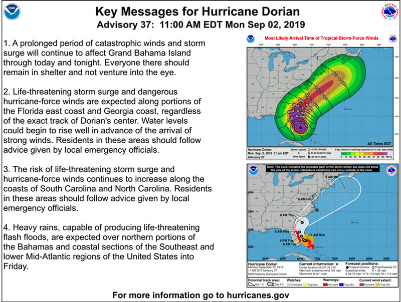
Serious storm effects are likely in coastal Georgia and the Carolinas in the middle and latter half of the week as Dorian picks up speed and heads north, but here, too, the risks are heavily dependent on the details of the storm track.
A hurricane landfall in the Carolinas, especially North Carolina, is a distinct possibility by late Thursday.
The latest on Hurricane Dorian
As of 10 a.m. Monday, the storm was 30 miles east-northeast of Freeport on Grand Bahama Island and drifting west at just 1 mph.
The storm’s peak winds were 160 mph, making it a Category 5 storm.
Dorian has maintained Category 4 and now Category 5 intensity since Saturday, an unusually long period.
(Hurricane Dorian has been downgraded to a Category 4 storm but remains powerful and life-threatening with 155 mph winds. Category 5 storms begin at 156 mph winds. Courtesy of MSNBC and YouTube. Posted on Sep 2, 2019.)
Continue reading… ‘Catastrophic’ Hurricane Dorian blasting Bahamas while bearing down on Florida, threatening Georgia and the Carolinas
Learn More…
NOAA Hurricane Safety Tips and Resources
Important NOAA Weather Radio All Hazards and Emergency Alert System Changes
(Storm surge is water from the ocean that is pushed toward the shore by the force of the winds swirling around the hurricane. It is the greatest threat to life during a hurricane. Courtesy of NOAA and YouTube. Posted on Mar 18, 2013.)
Hurricanes are among nature’s most powerful and destructive phenomena.
On average, 12 tropical storms, 6 of which become hurricanes form over the Atlantic Ocean, Caribbean Sea, or Gulf of Mexico during the hurricane season which runs from June 1 to November 30 each year.
In the Central Pacific Ocean, an average of 3 tropical storms, 2 of which become hurricanes form or move over the area during the hurricane season, which runs from June 1 to November 30 each year.
Guam, the Northern Marianas and Micronesia experience typhoons all year round but the main season in July through November with a peak from mid-August to mid-September.
Over a typical 2-year period, the U.S. coastline is struck by an average of 3 hurricanes, 1 of which is classified as a major hurricane (winds of 111 mph or greater).
By knowing what actions to take before the hurricane season begins, when a hurricane approaches, and when the storm is in your area, as well as what to do after a hurricane leaves your area, you can increase your chance of survival.
Read stories from survivors and learn how to stay safe.
Hurricane Hazards
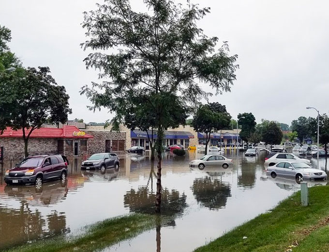
While hurricanes pose the greatest threat to life and property, tropical storms and depression also can be devastating.
The primary hazards from tropical cyclones (which include tropical depressions, tropical storms, and hurricanes) are storm surge flooding, inland flooding from heavy rains, destructive winds, tornadoes, and high surf and rip currents.

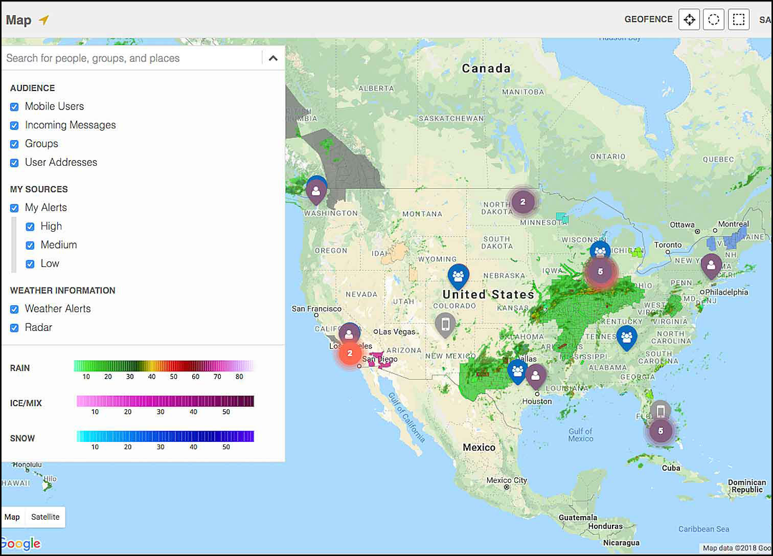
AlertMedia is known for mass notifications, but we also support efficient communications throughout the life of any event – from planning through resolution.
-
Storm surge is the abnormal rise of water generated by a storm’s winds.
-
This hazard is historically the leading cause of hurricane related deaths in the United States.
-
Storm surge and large battering waves can result in large loss of life and cause massive destruction along the coast.
-
-
Storm surge can travel several miles inland, especially along bays, rivers, and estuaries.
-
Flooding from heavy rains is the second leading cause of fatalities from landfalling tropical cyclones.
-
Widespread torrential rains associated with these storms often cause flooding hundreds of miles inland.
-
This flooding can persist for several days after a storm has dissipated.
-
- Winds from a hurricane can destroy buildings and manufactured homes.

-
-
Signs, roofing material, and other items left outside can become flying missiles during hurricanes.
-
-
Tornadoes can accompany landfalling tropical cyclones.
-
These tornadoes typically occur in rain bands well away from the center of the storm.
-
-
Dangerous waves produced by a tropical cyclone’s strong winds can pose a significant hazard to coastal residents and mariners.
-
These waves can cause deadly rip currents, significant beach erosion, and damage to structures along the coastline, even when the storm is more than a 1,000 miles offshore.
-
Original post https://www.weather.gov/safety/hurricane.
(The National Oceanic and Atmospheric Administration’s work spans from the bottom of the sea to the surface of the sun. Each day, our employees take the pulse of the changing world around us and share that knowledge with others to ensure public safety, protect and restore marine resources, and strengthen our economy. We are scientists, engineers, researchers, technicians, and more who remain united in our common mission: science, service, stewardship. Courtesy of NOAA and YouTube. Posted on Jan 25, 2018.)
AST strives to meet a 3 STAR trustworthiness rating, based on the following criteria:

- Provides named sources
- Reported by more than one notable outlet
- Includes supporting video, direct statements, or photos


