


Leidos has been awarded a task order by the Federal Aviation Administration (FAA) to develop the 7th Generation geostationary earth orbit (GEO) satellite used for the FAA Wide Area Augmentation System (WAAS).
The task order has a four-year development phase, and one 10-year Operations and Maintenance phase with a total contract value of approximately $117 million. Work will be performed in Gaithersburg, Md.
The task order supports the WAAS, a safety-critical system that augments Global Positioning System (GPS) Standard Positioning Service (SPS).
WAAS is an extremely accurate navigation system developed for civil aviation.
Wide Area Augmentation System – How It Works
- Unlike traditional ground-based navigation aids, the WAAS covers nearly all of the National Airspace System (NAS).
- The WAAS provides augmentation information to GPS receivers to enhance the accuracy and reliability of position estimates.
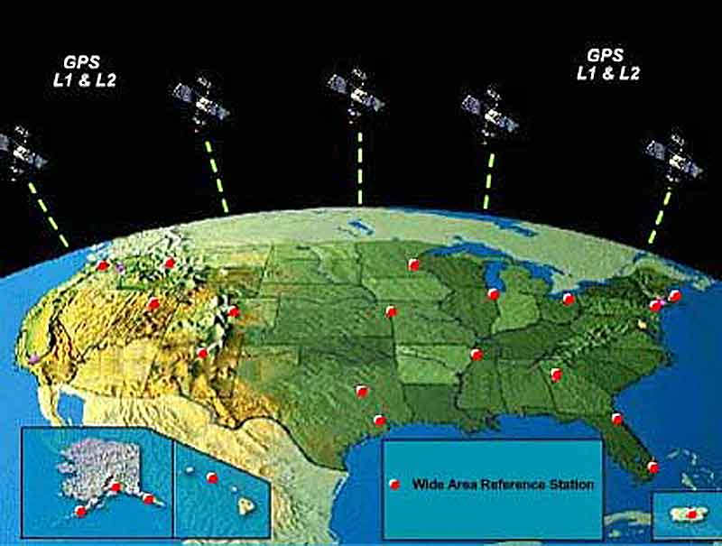
- The signals from GPS satellites are received across the NAS at many widely-spaced Wide Area Reference Stations (WRS) sites.
- The WRS locations are precisely surveyed so that any errors in the received GPS signals can be detected.
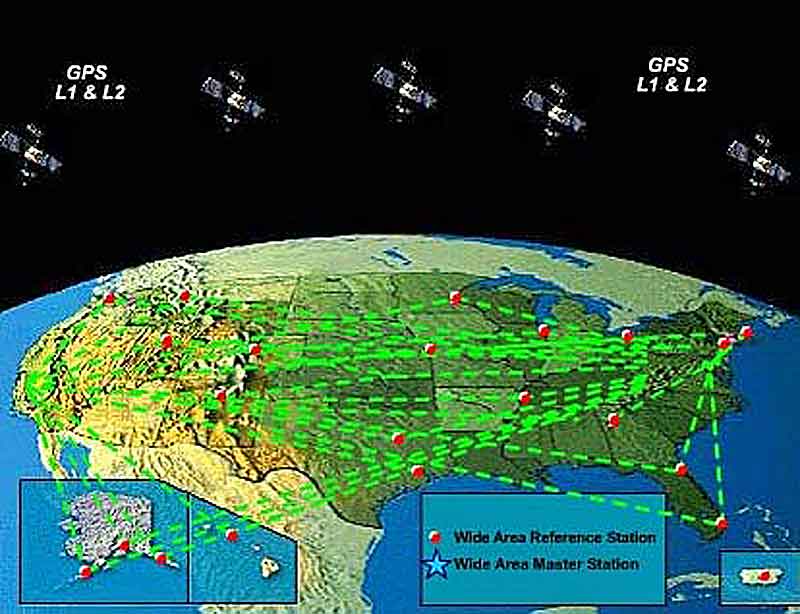
- The GPS information collected by the WRS sites is forwarded to the WAAS Master Station (WMS) via a terrestrial communications network.
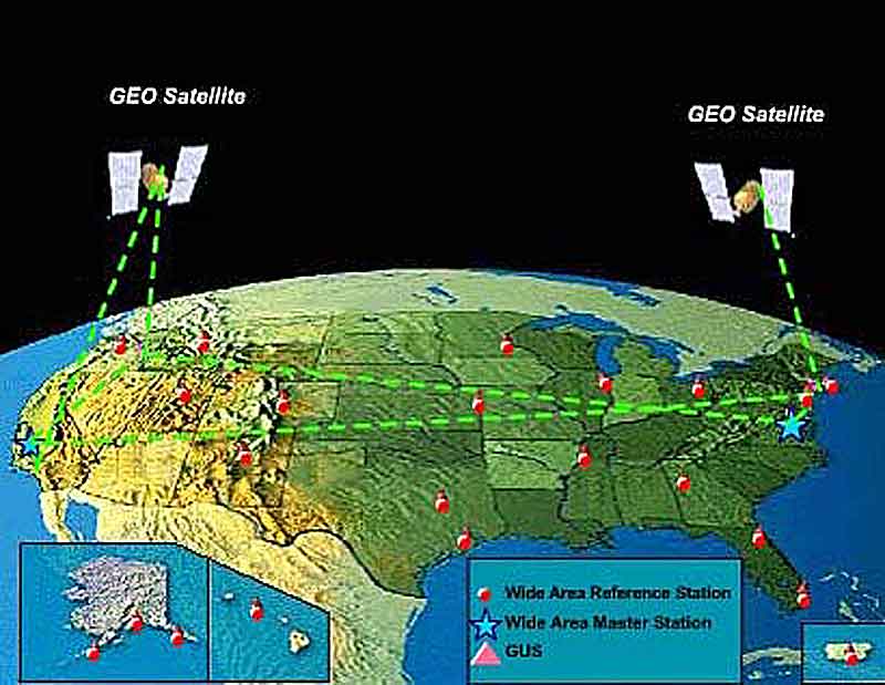
- At the WMS, the WAAS augmentation messages are generated.
- These messages contain information that allows GPS receivers to remove errors in the GPS signal, allowing for a significant increase in location accuracy and reliability.
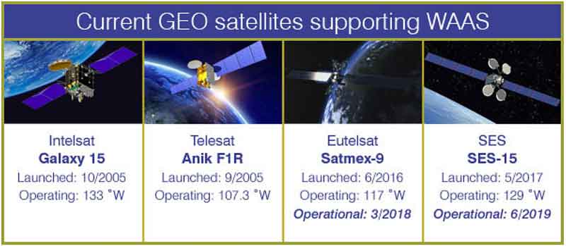
- The augmentation messages are sent from the WMS to uplink stations to be transmitted to navigation payloads on Geostationary communications satellites.
The navigation payloads broadcast the augmentation messages on a GPS-like signal. The GPS/WAAS receiver processes the WAAS augmentation message as part of estimating position. The GPS-like signal from the navigation transponder can also be used by the receiver as an additional source for calculation of the user’s position.
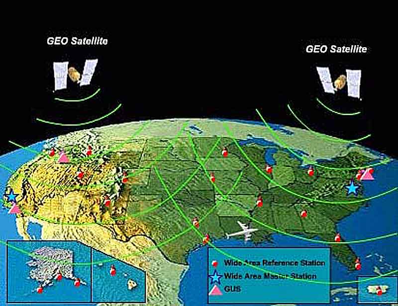
- WAAS also provides indications to GPS/WAAS receivers of where the GPS system is unusable due to system errors or other effects.
- Further, the WAAS system was designed to the strictest of safety standards – users are notified within six seconds of any issuance of hazardously misleading information that would cause an error in the GPS position estimate.
Before WAAS, the U.S. National Airspace System (NAS) did not have the potential to provide horizontal and vertical navigation for approach operations for all users at all locations. With WAAS, this capability is a reality.
As a result, WAAS enables aircraft to rely on GPS for all phases of flight, including precision approaches to any airport within its service area.
Leidos, along with space-segment provider Intelsat General Corporation and technology partners U.S. Electrodynamics, Inc. (USEI) and Knight Sky, will develop, test and integrate a satellite payload for the program’s new GEO 7 satellite and its associated pair of ground uplink stations.
The stations then broadcast GPS navigation data that is corrected and enhanced for accuracy.
Leidos will also manage the stations to ensure the satellite sends the augmented GPS navigation signals in line with WAAS requirements.


