


Extended stretches of U.S. land borders invite illegal entry on the ground, and our coastlines are often used by non-citizens for unauthorized seaborne entry.
Creative attempts at new illegal activity in these domains are a occur daily.
Aerial threats pose additional challenges as they have no natural barriers to restrict them.
Airborne illegal entry issues call for expert input from a broad range of public, private, and interagency partners.

Commercialization of drone technology (also known also unmanned aerial systems or UAS), for all the beneficial opportunities it offers, also enables a new medium for criminal activity and other homeland security threats.
The protection of American skies will demand more than ever an effective air surveillance sensor network.
Optimizing this begins with an accurate assessment of current air surveillance capabilities and how they operate together.
Towards that end, Department of Homeland Security (DHS) Science and Technology Directorate (S&T) is creating standards for air surveillance, known as DHS (Interim) Strategic Air Surveillance Requirements (I)SASR.
DHS, the Federal Aviation Administration (FAA), the Department of Defense (DOD), and the National Oceanic and Atmospheric Administration (NOAA) are currently working together to ensure future U.S. air surveillance capabilities meet our nation’s security and aviation safety needs.
S&T supports this interagency initiative by assessing the degree to which both current and future proposed radar solutions can meet the country’s needs.
S&T applies modeling and simulation expertise to simulate air traffic and assesses how well current U.S. air surveillance capabilities meet the detection standards established by the DHS (I) SASR.
“S&T’s analysis will provide CBP Air and Marine Operations a detailed understanding of where the DHS (Interim) Strategic Air Surveillance Requirements are being met and where there are gaps in required coverage,” said the Arch Turner, an Operations Analysis Chief at S&T.
Today, more than 300 radars around the country attempt to detect and determine the geographic location of all non-commercial aircraft, from tiny drones to larger manned aircraft such as private and business aircraft and gyrocopters.
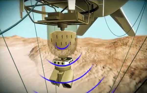
Among these radars are tethered aerostats, balloon-like systems which enable elevation of radars to heights of 10,000 feet or more.
Termed Tethered Aerostat Radar Systems (TARS), they are placed primarily along the U.S. southwest border to provide much needed, and otherwise unavailable, ability to detect and track aircraft flying at very low altitudes.
Using Extended Air Defense Simulation (EADSIM) modeling and simulation software, analysts can simulate every radar currently supporting CBP AMO’s critically important air surveillance efforts and assess their ability to detect incoming aircraft.
(Learn More. TCOM Video that showcases our platforms and describes features, functionality and capabilities. Courtesy of TCOM LP and YouTube)
S&T analysts can even use EADSIM to watch in real-time as the simulated radars detect suspicious aircraft targets.
EADSIM then provides analytic data, which includes geographic location of detection as a function of a target’s altitude and radar cross section, which measures how large a given aircraft appears to radars.
Analysts have relied on EADSIM to model aircraft, sensors and missiles for more than three decades.
The model has been used to shape and understand the effectiveness of aircraft and ballistic missile defense systems.
The commercialization of drones means U.S. air surveillance sensors are likely to encounter a higher volume of very small and difficult to detect air traffic in the future.
This will require both more radars and more sensitive radars.
This is where S&T’s partnership with the interagency, DHS operating components and industry can play a vital role in public safety by helping to ensure the U.S. can effectively maintain situational awareness of all aircraft within its national airspace.
The current interagency effort to modernize the U.S. air surveillance network is motivated in part by government plans to auction to the commercial sector L-band (1-2 GHz) radio-frequency spectrum used by many existing U.S. radars.
This means these radars must be taken out of service to avoid interference.
Once candidates for replacing this lost surveillance capability are examined and confirmed by CBP AMO, S&T HSARPA and S&T through simulation and analysis, the government will select the best alternative and work with industry to develop and deploy it to ensure the best achievable surveillance of U.S. airspace.
(A U.S. Customs and Border Protection Air and Marine Operations P-3 Orion aircrew patrols the Caribbean and Eastern Pacific to interdict contraband before it reaches the shores of the United States. Using sophisticated sensors and radar equipment, the aircrew covers thousands of miles of open ocean hunting for narcotics. In Fiscal Year 2016, P-3 aircrews contributed to 145 drug seizure or disruption incidents, resulting in the interdiction of 34,108 pounds of marijuana and 193,197 pounds of cocaine. Courtesy of U.S. Customs and Border Protection and YouTube)
“S&T’s work is exactly the type of detailed analysis that is necessary for the Department to mature in its decision-making,” said Drew Kuepper, Deputy Assistant Secretary for Policy (Unity of Effort Integration).
In performing its analytical work, the S&T team collaborates closely with CBP radar technical experts to coordinate and review their findings.
This helps ensure a common and more thorough understanding of current air surveillance capabilities and shortfalls, how requirements can be most cost-effectively achieved, and helps pave the way for interagency discussion of joint requirements for future aircraft surveillance.
Frequent collaboration between S&T and CBP AMO allows them to be optimistic about the future of the project.
S&T has received very positive feedback on this work from its customers, some of whom expressed their surprise that modeling, simulation and analysis capability of this kind is available in DHS.


