


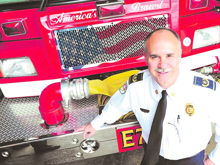
Guest Editorial by Charles Werner, Director – DRONERESPONDERS
Public Safety drone operations are now being used by every public safety discipline (Fire, EMS, Law Enforcement, Correctional Officers, Emergency Management, Search and Rescue, Park Rangers, Conservation Officers, Lifeguards, and at every level of government, including local, state, territorial, tribal and federal agencies and is greatly enhancing public safety and homeland security.
 While not all public safety agencies are using drones yet, DRONERESPONDERS (a 2022 ‘ASTORS’ Homeland Security Award Winner for Excellence in Public Safety and Emergency Response) predicts that within five years, drones will become an essential tool within most departments’ toolboxes.
Based on the DRONERESPONDERS 2020 Research on public safety COAs and Part 107 remote pilots, it is estimated that over 5000 public safety agencies have implemented drone programs, with more added every day.
In 2020, DRONERESPONDERS Research Study revealed over 17 major use cases with numerous subcategories.
In the past, public safety agencies’ aerial operations were limited to piloted helicopters and fixed-wing aircraft. The number of agencies nationwide with piloted aircraft programs is estimated to be at or below 300 due to aircraft and operational costs.
By no means do drones eliminate the need for piloted aviation programs due to present drone limitations; however, the value of aerial operations to enhance safety, improve operational effectiveness, and provide real-time streaming situational awareness is resulting in the dramatic growth in the number of public safety drone programs.
In addition, recent FAA regulatory changes have simplified many drone waivers and made it easier to implement drone programs.
When it comes to public safety use cases, here is an overview:
Structure Fires
Structure fire overwatch can provide thermal signature assessment, scene documentation, and apparatus location. Imagery can be used for after-incident review and training.
Thermal viewing through smoke helps firefighters to see the fire spread and to aim to elevate water streams through the smoke to ensure the direct application of water on the fire.
Thermal imagery also helps to identify structural integrity issues from fire and possible collapse areas and prevent firefighters from dangerous roofs.
(Footage of smoke coming from a Gilbert home that caught fire in April was captured by a drone. A man was found deceased following the fire. Video courtesy of Markeandersonphotography, FOX 10 Phoenix, and YouTube. Posted on Apr 15, 2023.)
Additionally, aerial views allow firefighters to visually monitor the progress or lack of firefighting operations, fire spread, and extension to other buildings.
Wildfires
Wildfires have become one of the most beneficial from pre-fire ground fuel assessment on the forest floor and preventive fuel load mitigation at the urban-wildland interface.
Use for overwatch and assessment of fire spread, speed, direction, intensity, and proximity to firefighters. Prescribed burns or backfire operations benefit by dropping incendiary devices to burn ground fuel ahead of advancing fire.
(Learn More… Prescribed burning is a land management tool with countless benefits, from reducing fuel loading and the risk of a catastrophic wildfire to clearing out unwanted vegetation, invasive species, pests, etc. It also recycles nutrients into the soil, creating an environment with new native growth and abundant grazing opportunities for wildlife. Courtesy of Texas A&M Forest Service and YouTube. Posted on Feb 24, 2021.)
After the fire knockdown, a thermal assessment can be conducted to identify remaining hot spots to ensure complete overhaul and extinguishment. After the fire, the forest floor can be assessed for remaining fuel on the forest floor and to understand the remaining wildfire threat.
Hazmat
Zazmat drones can provide an advanced look at a situation from above to identify hazards that may not be seen from the ground – initial assessment and pre-entry of personnel, making entry safer and more effective.
Drone overwatch can identify the direction of a hazmat liquid spill and gaseous/toxic cloud or plume. A sensor payload can be used to ID gas/chemical release.
A perched drone with props off can conduct remote sensing/monitoring operations for hours.
(Walt Lewis and company examine how using drones can help with size-up and information-gathering processes at hazmat incidents. Courtesy of Fire Engineering and YouTube. Posted on Sep 14, 2020.)
Monitoring of HM operation provides visual progress of mitigation efforts and maintains a watch on HM technicians.
This also maintains a safety observation for changing conditions (which may not be visible from the ground) and for a secondary method to warn personnel if normal communications are compromised.
Drones can also drop needed tools near technicians to assist with repairs without the need to return for tools.
For train derailments, it provides a look at the big picture quickly as to how many rail cars are derailed, if any are leaking or on fire, identify hazmat rail cars, travel of any liquid or gas release, contamination of waterways, any obvious injuries and to access derailments in extremely rural inaccessible areas.
(Drone video from a train accident and fire, was captured by a drone in East Palestine, Ohio, Courtesy of ABC 7 Chicago and YouTube. Posted on Feb 5, 2023.)
For transportation incidents, drones provide the ability to fly closer and look into cargo trailers on tractor-trailers to determine what is involved without placing anyone in harm’s way.
Maintaining an overwatch of major chemical fires (from a safe distance) has proven extremely beneficial in determining the direction of spread, intensity, effectiveness of firefighting operations, and direction of toxic smoke or chemical runoff.
A drone thermal camera can identify liquid levels in containers, invisible plumes, or gas clouds and if there are potential container integrity issues.
Technical rescues
During high-angle rescue situations, drones help determine the situation and the condition of the person/s and identify the necessary equipment to effect the rescue and to maintain visual progress throughout the rescue, which may not be visible from ground location.
(See how Jacksonville Fire Rescue Department responded to a high-angle rescue of a worker trapped in a lift 180ft in the air. The special operations team rigged a lowering system to lower the worker harnessed in a halfback to a landing. The worker was then transferred to a stokes basket, lowered to the ground from there, and then transported to the hospital to get checked out with non-life threatening injuries. Courtesy of THEJFRD and YouTube. Posted on Aug 8, 2022.)
Confined space rescues use drones to determine the location and condition of victims, the best access, and to determine O2 level or hazardous gases present without endangering rescuers.
Water rescues deploy drones to more quickly identify the location and condition of victims, determine the direction of water flow, and the ability to drop personal flotation devices, and it is safer for both the rescuer and distressed swimmer.
(Drone footage from WeatherNation field correspondent Brandon Clement of historical flooding in Vermont’s Capitol on Tuesday morning. Courtesy of WeatherNation and YouTube. Posted on Jul 11, 2023.)
Ice rescues use drones to assess the situation and quickly drop ropes or other devices to assist in pulling victims or animals to safety without rescuers traversing dangerous breaking ice.
Searching for lost persons, drones can be used to quickly fly over large open areas and/or rough terrain to locate lost persons using various payloads such as visual optics, thermal imaging, lights, listening devices, audio/speaker, and AI payloads for sound type recognition (crying, yelling, sobbing, etc.
They are also used to locate persons with dementia and autism quickly.
(See how the Bullitt County Sheriff’s Office in Kentucky purchased its first drone on Nov. 1 and used it to possibly save a life three days later when it helped investigators find a missing woman in a wooded area. Chief Deputy Alex Payne said buying the $16,000 drone was money well spent and expects it to be put to good use in the future. Courtesy of WDRB News – Official and YouTube. Posted on Nov 8, 2022.)
Disaster Assessments
Drones provide the first look and understanding of “how bad is bad” by capturing impacted areas, locating lost/injured people, seeing property damage, identifying damage to critical infrastructure like utilities/power grid/hospitals, determining inaccessible/impassable roads, identifying hazards, calculating debris piles and better-determining resources needed to recover.
This includes wildfires, floods, mudslides, tornadoes, hurricanes, dust storms, severe thunderstorms, earthquakes, and avalanches.
(See how drones are becoming a vital tool for law enforcement and other first responders, as agencies from around the country met in Colorado to train with some of the latest drone technologies. Courtesy of CBS This Morning and YouTube. Posted on Jun 7, 2019.)
Drones also provide great value in monitoring the community recovery process of things like receding flood waters, reopening of roadways, the progress of debris pile removal, business reopenings, and more.
Beach/Lifeguard Operations
These operations are growing in drone deployment as larger areas can be monitored more quickly and safer for rescuers. Many beaches have initiated drone patrols for swimmer safety, to locate and rescue swimmers in distress, and to drop flotation devices.
Shore/beach patrols with drones monitor for sharks, alligators, and crocodiles plus clear people away from areas where these dangers exist.
New AI software can automatically distinguish the type of animal threat. Many of these drone operations have replaced helicopter operations or are used to complement helicopter patrols.
Forensics
Drones are used both inside and out to capture incident scene information. Forensics can create 3D models that can be used to review an incident scene later.
Forensics are increasingly used for fire scene investigation, traffic crash reconstruction (completed in one-third of the time), law enforcement scene investigation, and scene documentation.
(First responders have some of the most difficult jobs on the planet. On a daily basis, they put their safety on the line to protect our communities. Public safety drones hold enormous potential to help first responders accelerate emergency response and gain privileged situational awareness from a safe position. Courtesy of Skydio and YouTube. Posted on Jan 2, 2023.)
Drone as a First Responder (DFR)
DFR is a new and growing trend to launch drones from rooftops upon the immediate receipt of a 911 emergency call to provide aerial reconnaissance before law enforcement ground units arrive.
This reconnaissance helps to ensure the appropriate response and, many times, releases ground units even before their arrival, freeing them to respond to other calls.
(Forsyth County Sheriff’s Office in North Carolina is one of the growing list of agencies around the country utilizing drone as first responder (DFR) programs to respond to 911 calls autonomously in under two minutes. Courtesy of DroneSense and YouTube. Posted on Jun 5, 2023.)
DFR has served as a key de-escalation tool as it better informs officers of the actual situation, dramatically decreasing the known hazard.
DFR also serves as a force multiplier, as many departments face staffing shortages.
Law Enforcement
Law enforcement is the most widely and positively impacted public discipline by drones and represents about 70% of all public safety drone programs.
The areas of use include but are not limited to hostage situations, SWAT operations, active shooter, incident documentation/forensics, traffic crash reconstruction, K9 operations, internal room clearing, scene overwatch (both tactical & tethered drones), patrol operation, traffic safety operations, traffic enforcement, overwatch of major events, advance of tactical entry for scene reconnaissance, border patrol, drug deal, capture fleeing suspects, monitoring new traffic patterns before becoming permanent and more.
Park Rangers/Conservation Officers/Game Wardens
These officers use drones not only for law enforcement but also for park management, such as searching for lost hikers, forest management, animal management, trails, and more.
For law enforcement purposes, drones help deal more effectively with illegal hunting, poaching enforcement, and trespassing.
This can be done quicker over larger areas and is often safer for the officers.
Correctional/Prison Facilities
Drones are used at prisons for security overwatch of facilities and perimeter patrols, inspection of perimeter fences, etc.
With recent issues of drone contraband delivery, perimeter patrol has become more important.
(Drone drops deliver drugs right inside the walls of California state prisons. The alleged felony flights have led to a federal complaint against four men, including two in the Sacramento region. Courtesy of CBS Sacramento and YouTube. Posted on Apr 19, 2023.)
Drones also give the quickest and widest view when searching for a prisoner escapee with visual optics and thermal cameras.
Critical Infrastructure
Inspection of critical infrastructure that may have become damaged from natural or manmade events (bridges, tunnels, dams, levies, railroad tracks, buildings, nuclear power plants, utilities, etc.).
Periodic inspection can easily and more affordably be monitored during times of concern.
(For example, the utility industry is constantly evolving, and with that evolution comes new technologies that can help streamline processes and improve efficiency. One such technology is drone powerline inspection, which has the potential to revolutionize the way that utility companies inspect and maintain their infrastructure. Courtesy of Skydio and YouTube. Posted on May 26, 2023.)
Miscellaneous Drone Operations
Non-traditional uses of drones now include training, pre-fire planning of high-risk facilities, fire station construction projects, community demonstrations, public fire education, and public safety recruiting, or capturing various phases of local building construction to better understand how fires will travel through a building.
Expanding to Other Public Service Departments
The use of drones is also having a major increase of interest by other public service departments beyond public safety like public works, parks and recreation, zoning, community development, tourism, building inspections, code enforcement, land management, water management, GIS, and more.
Drones impact almost every vertical because they can do dull, dirty, and dangerous operations and because drone inspections can be much more efficient than traditional ground operations such as solar panel inspections, roof inspections, wind turbine inspections, parking lot light assessments, measuring tree canopies, and more.
About the Author
Chief Charles Werner, the founder and director of DRONERESPONDERS Public Safety Alliance, is a Public Safety Advisor & Chair of the National Council on Public Safety UAS (NCPSU), a former Founder and Chair of the International Association of Fire Chief’s Technology Council (IAFC), and Fire Chief Chair Emeritus for the City of Charlottesville, Virginia.
Chief Werner was recently Honored with the Meritorious Award from the American National Standards Institute (ANSI) for his work advancing standards in the public safety UAS Standards area.
Additionally, Chief Werner was Recognized with a Lifetime Achievement Award from the Virginia Public Safety Innovation Center earlier this year for his collective work in public safety leadership, communications, interoperability, FirstNet, broadband, GIS, and drones.
“This award is really about all of you that have joined me along the way as mentors, colleagues, and friends,” Werner said on LinkedIn following the announcement.
“There is nothing that I have accomplished alone. So thank all of you!”
Chief Werner is a retired Charlottesville Fire Chief and Public Safety Veteran.
After retirement, he worked with the Virginia Department of Emergency Management as senior advisor/acting deputy state coordinator for two years.
Chief Werner has served in numerous local, state, and national leadership roles on public safety initiatives. He continues to share his expertise as an advisor and board member for public safety organizations.
Chief Werner is an author with 150+ internationally published articles and contributes to numerous other public safety publications. He has numerous commendations, including three Virginia Governor’s Awards of Excellence and the National Career Fire Chief Award.
Closer to home, Chief Werner was recognized for Excellence in Public Safety in American Security Today’s 2018 ‘ASTORS’ Homeland Security Awards Program.
DRONERESPONDERS Honored in 2022 ‘ASTORS’ Homeland Security Awards Program
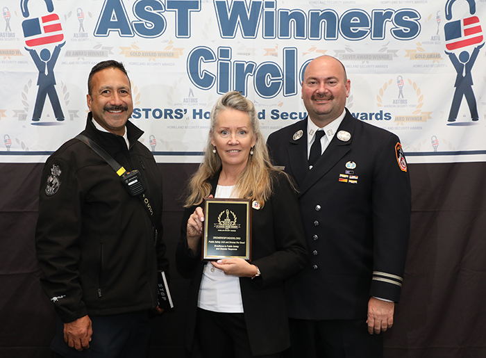
American Security Today’s Annual ‘ASTORS’ Awards is the preeminent U.S. Homeland Security Awards Program, and now in its Eighth Year, continues to recognize industry leaders of Physical and Border Security, Cybersecurity, Emergency Preparedness – Management and Response, Law Enforcement, First Responders, as well as federal, state and municipal government agencies in the acknowledgment of their outstanding efforts to Keep our Nation Secure.
DRONERESPONDERS
Excellence in Public Safety and Disaster Response
DRONERESPONDERS is the leading non-profit program created to unite new aerial first responders, emergency managers, and search and rescue (SAR) specialists under a unified organization to help them to learn, train, and test with one another, with the ultimate objective of maximizing drone operations for public safety and countering the growing threats of rogue drones.
DRONERESPONDERS is the leading nonprofit program to advance public safety UAS with over 7500 members and participation from 87 countries.
(Catch a glimpse as to why DRONERESPONDERS is the world’s fasted growing non-profit program supporting public safety UAS! Courtesy of DRONERESPONDERS and YouTube.)
-
DRONERESPONDERS ranks are growing each day as more organizations embrace the use of UAS for public safety missions.
-
The DRONERESPONDERS program is led by Chief Charles Werner (ret.), who serves as the director, and is himself a 2018 ‘ASTORS’ Homeland Security Award Winner for ‘Excellence in Public Safety.’
-
Chief Werner is a Public Safety Advisor & Chair of the National Council on Public Safety UAS (NCPSU), a former Founder and Chair of the International Association of Fire Chief’s Technology Council (IFAC), a Public Safety Advisor for the National Center for Security & Preparedness at the University at Albany, and Fire Chief Chair Emeritus for the City of Charlottesville, in North Carolina.
-
DRONERESPONDERS hosts the largest online Resource Center with over 800 documents of best practices, lessons learned, SOPs, checklists, starting a drone program guide, FAA waiver guides, and more.
-
DRONERESPONDERS also hosts a Public Safety Drone Directory and Dashboard (Dashboard.DRONERESPONDERS.org), with over 1300 agencies sharing their UAS program information.
-
DRONERESPONDERS is open to all (even non-public safety), and membership, and all resources are free.
-
Join today and share with others. To learn more or join up today, please visit www.droneresponders.org.


