


Sometimes, being out of touch with the rest of the world can be a relaxing change – like when you are on a much anticipated vacation.
But for law enforcement officers coordinating and participating in a dangerous operations across air, land, and sea to stop drug trafficking, patchy cellphone services can prevent agents from completing their missions and put them in harm’s way even more!
For the Joint Interagency Task Force South (JIATFS), for example, reliable communications make it possible for agents to catch illegal drug and human traffickers.
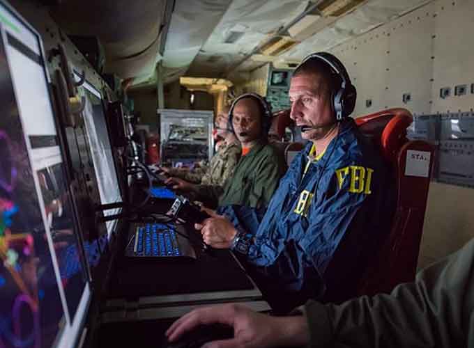
(Learn More. Joint Interagency Task Force South on Key West, Florida, a multi-agency, international alliance whose mission is to cover 42 million square miles of territory primarily in Central and South America to stem the flow of illegal drugs and to disrupt and dismantle sophisticated narco-trafficking networks. Much of that work is carried out on the high seas. Courtesy of the FBI – Federal Bureau of Investigation and YouTube. Posted on Dec 7, 2016.)
JIATFS detects and monitors illegal trafficking in the air and on the water, and supports international and interagency operations that stop illegal drug trafficking.
It operates in waters covering 42 million square miles of the western hemisphere, predominately with its 30 official partner nations, where cell service is all but non-existent.
This makes effective, tactical-level communication through traditional means difficult, which can result in missed opportunities to stop and arrest illegal traffickers.
Recent tests integrating commercial and government capabilities is making tactical communications between international and interagency law enforcement operators safer and more reliable.
In early 2018, the Department of Homeland Security (DHS) Science and Technology Directorate (S&T), JIATFS Innovation and Technology Directorate (J7), and the National Geospatial-Intelligence Agency (NGA) joined forces to identify innovative capabilities that improve communication in maritime environments where cell coverage is lacking.
(Learn More about the Joint Interagency Task Force South (JIATFS) and YouTube. Courtesy of Doug Brumbaugh and YouTube. Posted on Jun 19, 2015.)
This cooperative endeavor, the Mobile Maritime Command and Control (M2C2) Project, aimed to demonstrate how integrating commercial communication capabilities with existing government information capabilities could enhance awareness and improve near real-time communications in maritime domains with poor cell coverage.
“The technology is mature and available. We just need to integrate it all together,” explained the JIATFS Development and Integration Division Chief Jeff Stahl.
The M2C2 team scouted potential solutions from industry and government research and development programs, and used commercial-off-the-shelf (COTS) tools and government-off-the-shelf applications in a recent proof-of-concept technology demonstration at Naval Air Station Key West, Florida.
The team used a portable, COTS satellite Wi-Fi hotspot system connected to an iPhone loaded with NGA’s Mobile Awareness GEOINT Environment (MAGE) application.
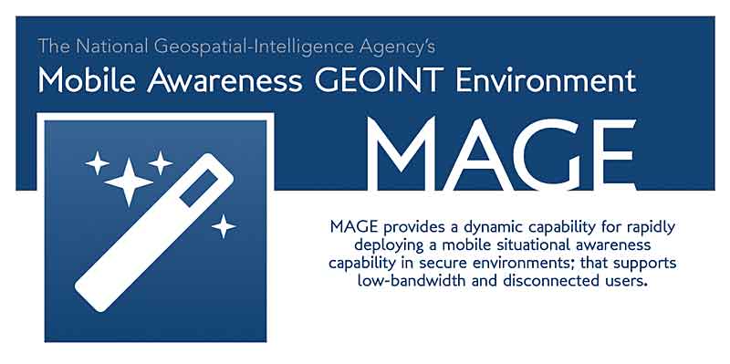
MAGE is a dynamic, secure, mobile situational awareness platform that can be rapidly deployed and customized for teams and events and designed to accommodate low-bandwidth and disconnected users.
NGA released MAGE as an open-source, publicly available capability that is available to partner nations.
One of the goals of MAGE is to increase capability of partner nations supporting the JIATFS mission.
MAGE worked with the Cooperative Situational Information Integration (CSII) web application, a web-based, unclassified, information-sharing network designed to allow the United States and partner nations’ to exchange and track information to improve domain awareness.
The M2C2 Project sought to connect to the secure MAGE application on an iPhone connected to the COTS satellite Wi-Fi hotspot system in a maritime area without cell or Wi-Fi services.
In tests, MAGE and CSII exchanged near real-time geolocation updates on tracks of interest.
This smoother communication could make it easier for operators on and offshore to work together and share information effectively when tracking suspicious boats or inspecting fishing vessels for contraband.
The demonstration first developed and tested three scenarios.
- The first scenario tested the components on land.
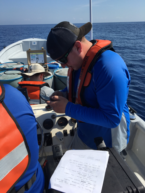
- The second and third scenarios tested the system’s ability to report its geo-location and receive tracks of interest while offshore and out of cell range. For the second and third scenarios, JIATFS used its 32 ft. “go-fast” boat, “Gotcha,” to travel approximately 17 nautical miles off the coast of Key West.
- An additional scenario assessed whether the system could enhance communication and reporting for United States Coast Guard (USCG) boarding teams.
“Our goal was to demonstrate the technical viability of the concept, and capture enough data to determine how we could operationalize the capability,” Stahl said.
The first phase of M2C2 scenario testing successfully demonstrated enhanced awareness and improved communications in the maritime domain using the M2C2 methodology.
“These successful tests demonstrated that the concept is technically viable. The data we captured during test will help us to employ M2C2 in an operational setting,” said Darryl Kramer, a DHS S&T Program Analyst who is serving as a Liaison Officer between JIATFS and DHS S&T, to help deliver enhanced capabilities for improved operational mission effectiveness.
Future phases of testing, combining United States and partner nation assets, are being considered.
(See More. We get drugs. Key west, GTMO, bermuda, panama, costa rica, Mexico, El Salvador. Order of the ditch & shellback. Courtesy of Cody Beeda and YouTube. Posted on Nov 17, 2016.)
Located at Naval Air Station Key West, Florida, Joint Interagency Task Force South (JIATFS), conducts detection and monitoring (D&M) operations throughout their Joint Operating Area to facilitate the interdiction of illicit trafficking in support of national and partner nation security.
JIATFS coordinates with the interagency and international partners to illuminate transnational organized crime networks and support interdiction and apprehension by U.S. and Partner Nation law enforcement agencies.


