The U.S. Air National Guard (ANG) will soon be able to conduct airborne assessment of natural disasters across wider areas and greater distances than ever before with the successfully completed Operational Assessment of UTC Aerospace Systems DB-110 airborne reconnaissance system on the General Atomics MQ-9 Reaper.
Conducted in fall 2017 by the 174th Attack Wing at the Syracuse Air National Guard Base, the assessment addressed the system’s utility for domestic operations missions, such as defense support for civil authorities during natural disasters.
(See the 147th Attack Wing celebrates the first-ever taxi of its new MQ-9 Reaper mission Jan. 5, 2018, at Ellington Field, Texas. Courtesy of MilitaryNotes and YouTube. Posted on Jan 7, 2018)
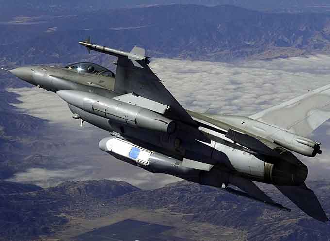
Currently in service with 14 countries around the world for military intelligence, surveillance and reconnaissance (ISR) missions, the DB-110 is a dual-band electro-optic and infrared reconnaissance pod that produces high-resolution day and night imagery, from overhead and at long ranges.
Operating in three fields of view and capable of collecting still imagery, it provides three-dimensional and stereo imagery, and wide-area persistence surveillance.
The DB-110 offers a significant capability improvement relative to the Guard’s existing sensors that have a comparatively shorter range and smaller field of view.
For example, while current systems have a slant range of roughly 15 nautical miles, the DB-110 is able to produce high-resolution imagery from a slant range of 80-plus nautical miles.
Additionally, the DB-110 provides an overhead view from higher altitudes and can collect more than 10,000 square miles of imagery per hour.
(Learn More. Dean Baxevanis, a business development manager at UTC Aerospace Systems, and Andrew Jeffrey, the company’s business development director, discuss the DB-110 Reconnaissance Pod, regional interest in the product, its business roadmap and more during a November 2017 interview with Defense & Aerospace Report Editor Vago Muradian at the 2017 Dubai Airshow. Courtesy of Defense & Aerospace Report and YouTube. Posted on Dec 19, 2017)
Ultimately, this significantly enhanced capability will allow the Guard to assess natural disasters more rapidly and more comprehensively, boosting operational efficiency in its humanitarian assistance operations.
Commanders anticipate using the sensor during such natural disasters as hurricanes, wildfires and floods.
UTC Aerospace Systems was contracted by the Guard in 2017 to support the installation and assessment of the DB-110 on the 174th Attack Wing’s MQ-9 Reaper.
Following the first Operational Assessment, the Guard is evaluating long-term solutions to field the next-generation sensor of the DB-110 family, the MS-110, in a new pod that will be compatible with both the MQ-9 Reaper and C-130 Hercules.
The MS-110 will produce multispectral color imagery across 7 bands, thereby enhancing the long-range and wide-area attributes of the DB-110.

For the Guard, the MS-110 would enhance the service’s ability to assess critical infrastructure during poor weather conditions, through smoke and below the surface of the water, while also helping to detect objects against a cluttered background.
“As the most advanced tactical-reconnaissance sensors of their kind, the DB-110 and MS-110 will greatly improve the Air National Guard’s ability to carry out its mission of saving lives and providing humanitarian assistance,” said Kevin Raftery, vice president of ISR and Space Systems at UTC Aerospace Systems.
“The imagery they provide will enable the timely assessment of critical infrastructure such as power plants, energy corridors, roads and highways, and civilian domiciles.”
“Collecting this information rapidly across wide areas and disseminating the data directly to incident commanders will help save lives and property during natural disasters and emergency situations.”


