The Defense Advanced Research Projects Agency (DARPA), is seeking information on state-of-the-art technologies and methodologies for advanced mapping and surveying in support of the agency’s 2018 ‘ASTORS’ Homeland Security Award Winning Subterranean (SubT) Challenge.
Georeferenced data, (i.e., geographic coordinates tied to a map or image) could significantly improve the speed and accuracy of warfighters in time-sensitive active combat operations and disaster-related missions in the subterranean domain.
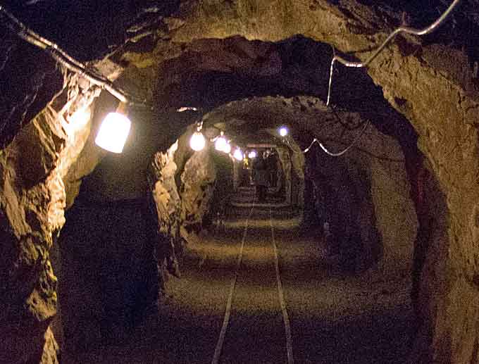
Currently, the majority of the underground environments are uncharted or inadequately mapped, including human-made tunnels, underground infrastructure, and natural cave networks.
(Learn More. Underground settings are becoming increasingly relevant to global security and safety. Rising populations and urbanization are requiring military and civilian first responders to perform their duties below ground in human-made tunnels, underground urban spaces, and natural cave networks. Recognizing that innovative, enhanced technologies could accelerate development of critical lifesaving capabilities, DARPA today announced its newest Grand Challenge: the DARPA Subterranean Challenge, or SubT for short. Courtesy of DARPAtv and YouTube. Posted on Dec 21, 2017.)
Through this recently released Request for Information, DARPA is looking for innovative technologies to collect highly accurate and reproducible ground-truth data for subterranean environments, which would potentially disrupt and positively leverage the subterranean domain without prohibitive cost and with less risk to human lives.
These innovative technologies will better equip warfighters and first responders to explore human-made tunnel systems, urban underground, and natural cave networks that are too dangerous, dark, dirty, or deep to risk human lives for deployment.
“What makes subterranean areas challenging for precision mapping and surveying – such as lack of GPS, constrained passages, dark or dust-filled air – is similar to what inhibits safe and speedy underground operations for our warfighters,” said Timothy Chung, program manager in DARPA’s Tactical Technology Office (TTO).
“Building an accurate three-dimensional picture is a key enabler to rapidly and remotely exploring and searching subterranean spaces.”
(Learn More. Complex underground settings present significant challenges for military and civilian first responders. The hazards vary drastically across domains that can degrade or change over time and are often too high-risk for personnel to enter. The DARPA Subterranean or “SubT” Challenge sought novel approaches to rapidly map, navigate, and search underground environments during time-sensitive combat operations or disaster response scenarios. Courtesy of DARPAtv and YouTube. Posted on Dec 3, 2018.)
DARPA is looking for commercial products, software, and services available to enable high-fidelity, 3D mapping and surveying of underground environments.
Of interest are available technologies that offer high accuracy and high resolution, with the ability to provide precise and reproducible survey points without reliance on substantial infrastructure (e.g., access to global fixes underground).

Additionally, relevant software should also allow for generated data products to be easily manipulated, annotated, and rendered into 3D mesh objects for importing into simulation and game engine environments.
DARPA may select proposers to demonstrate their technologies or methods to determine feasibility of capabilities for potential use in the SubT Challenge in generating and sharing 3D datasets of underground environments.
Such accurately georeferenced data may aid in scoring the SubT competitors’ performance in identifying and reporting the location of artifacts placed within the course.
(Learn More. The DARPA Subterranean Challenge was focused on the world beneath us – as competitors vie to rapidly and remotely map, navigate, and search complex underground environments. Courtesy of DARPAtv and YouTube. Posted on Nov 19, 2018.)
In addition, renderings from these data may provide DARPA with additional visualization assets to showcase competition activities in real-time and/or post-production.
Instructions for submissions, as well as full RFI details, are available on the Federal Business Opportunities website: https://www.fbo.gov/spg/ODA/DARPA/CMO/DARPA-SN-19-21/listing.html.
Submissions are due at 1:00 p.m. EDT April 15, 2019. Please email questions to SubTChallenge@darpa.mil.
DARPA Takes Platinum in the 2018 ‘ASTORS’ Homeland Security Awards Program
Defense Advanced Research Projects Agency – DARPA
-
‘Excellence in Homeland Security’
-
Subterranean (SubT) Challenge
(The DARPA Subterranean Challenge sought multidisciplinary teams from around the world to compete in the development of the autonomy, perception, networking, and mobility technologies necessary to map explore and search underground networks in unpredictable conditions.)
The Annual ‘ASTORS’ Awards Program is specifically designed to honor distinguished government and vendor solutions that deliver enhanced value, benefit and intelligence to end users in a variety of government, homeland security and public safety vertical markets.

The 2018 ‘ASTORS’ Awards Program drew an overwhelming response from industry leaders with a record high number of corporate and government nominations received, as well as record breaking ‘ASTORS’ Presentation Luncheon Attendees, with top firms trying to register for the exclusive high – end luncheon and networking opportunity – right up to the event kickoff on Wednesday afternoon, at the ISC East registration!
Over 130 distinguished guests representing National, State and Local Governments, and Industry Leading Corporate Firms, gathered from across North America, Europe and the Middle East to be honored among their peers in their respective fields which included:
- The Department of Homeland Security
- The Federal Protective Service (FPS)
- Argonne National Laboratory
- The Department of Homeland Security
- The Department of Justice
- The Security Exchange Commission Office of Personnel Management
- U.S. Customs and Border Protection
- Viasat, Hanwha Techwin, Lenel, Konica Minolta Business Solutions, Verint, Canon U.S.A., BriefCam, Pivot3, Milestone Systems, Allied Universal, Ameristar Perimeter Security and More!
The Annual ‘ASTORS’ Awards is the preeminent U.S. Homeland Security Awards Program highlighting the most cutting-edge and forward-thinking security solutions coming onto the market today, to ensure our readers have the information they need to stay ahead of the competition, and keep our Nation safe – one facility, street, and city at a time.
The 2018 ‘ASTORS’ Homeland Security Awards Program was Proudly Sponsored by ATI Systems, Attivo Networks, Automatic Systems, Desktop Alert, and Royal Holdings Technologies.
Early Bird Nominations are now being accepted for the 2019 ‘ASTORS’ Homeland SecurityAwards at https://americansecuritytoday.com/ast-awards/.
Comprehensive List of Categories Include:
| Access Control/ Identification | Personal/Protective Equipment | Law Enforcement Counter Terrorism |
| Perimeter Barrier/ Deterrent System | Interagency Interdiction Operation | Cloud Computing/Storage Solution |
| Facial/IRIS Recognition | Body Worn Video Product | Cyber Security |
| Video Surveillance/VMS | Mobile Technology | Anti-Malware |
| Audio Analytics | Disaster Preparedness | ID Management |
| Thermal/Infrared Camera | Mass Notification System | Fire & Safety |
| Metal/Weapon Detection | Rescue Operations | Critical Infrastructure |
| License Plate Recognition | Detection Products | And Many Others! |
Don’t see a Direct Hit for your Product, Agency or Organization?
Submit your category recommendation for consideration to Michael Madsen, AST Publisher at: mmadsen@americansecuritytoday.com.
2018 Champions Edition
 See the 2018 ‘ASTORS’ Champions Edition – ‘Best Products of 2018 ‘ Year in Review’ for in-depth coverage of the outstanding products and services of firms receiving American Security Today’s 2018‘ASTORS’ Homeland Security Awards.’
Enter Early to Maximize Media Coverage of your Products and Services at Kickoff, and Get the Recognition Your Organization Deserves!
And be sure to Register Early for the 2019 ‘ASTORS’ Awards Presentation Luncheon at ISC East 2019 to ensure your place at this limited- space event!


